|
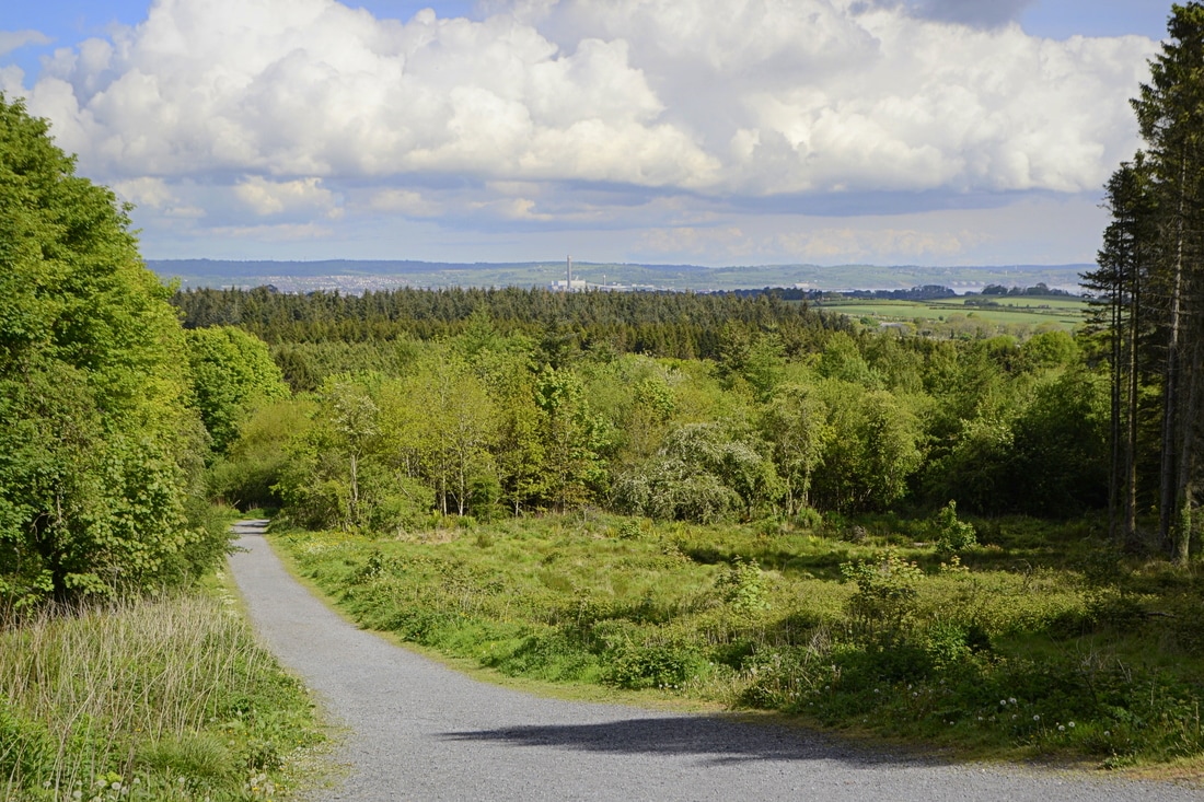
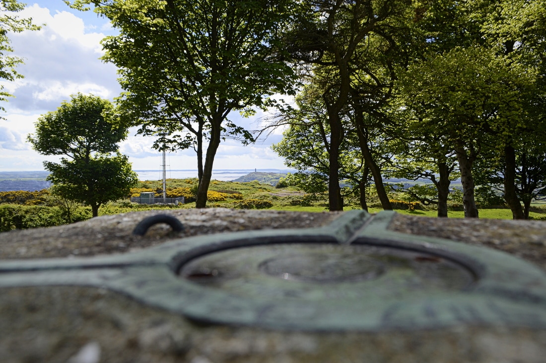
Cairngaver is a little known and relatively low, transmitter-topped hill in north County Down. Its 217m summit is the highest point in the Craigantlet Hills - a small range just northeast of Belfast City. Read Martin McAlinden's story of his second attempt to reach its summit. I’m slightly embarrassed now that I was unable to reach the 217m summit of Cairngaver on my first attempt back in 2009. In my defence, this was before the age of widespread smartphones equipped with hiking apps, GPS and 4G. I’d arrived somewhat ill-prepared following an appointment nearby, without a map and with only the knowledge that the summit lay beyond the top of Cairn Wood, a pretty forest popular with walkers. I’d followed the maze of trails ever upwards without any luck, ultimately reaching a quarry and not finding an obvious route beyond it. I decided to give Cairngaver another go recently, after visiting a friend living in Belfast. This time I was armed with the ViewRanger app which helpfully shows the main trails through the forest. Once again I started from the forest parking area on the B170, an inland route between Belfast and Bangor. I followed the main perimeter trail up to the top of the forest and then, knowing I should be aiming southeast, picked up a minor trail which gave a glimpse of the transmitters and led towards them. The summit area was reached after passing through gaps in a couple of hedges. Having skirted the quarry edge again, I realised that my mistake last time was thinking the summit was to the right of it rather than the left. Despite the various masts and service buildings, Cairngaver’s summit is quite a peaceful place, with a trig pillar topping an old cairn that’s shaded by trees. The views are surprisingly extensive, though you’ll have to walk around a bit to appreciate them. One thing that struck me was that this area of commuter towns is still very green and pretty when seen from above. Sights included part of Belfast and its surrounding hills, the familiar, jagged line of the Mourne Mountains to the south, the mouth of Belfast Lough and the Antrim Coast to the northeast, and across the sea to Scotland and even the Isle of Man; the first time I’ve been sure I’ve seen it from Ireland. Closer to hand was the fairytale Scrabo Tower rising above Newtownards, with the Ards Peninsula beyond. Having taken time to enjoy the various views, I headed back down the same way. This was a very enjoyable trip, not just because of the satisfaction in finally ‘conquering’ this obscure hill but because Cairngaver punches well above its modest height. Read more... This is a short version of an article from Martin McAlinden's own Hike Cycle Ireland blog. For the full story and a larger selection of photographs from Martin's Cairngaver walk, please visit his original article.
0 Comments
|
Thank you for visiting the High Point Ireland blog: the dedicated news feed of the High Point Ireland website. Feel free to get in touch if you would like to become a guest blogger. Archives
June 2017
Categories
All
|
- Locations
- The Championships
-
Community
- Social media
- Individuals
-
Teams
>
-
County Teams
>
- Team County Antrim
- Team County Armagh
- Team County Carlow
- Team County Cavan
- Team County Clare
- Team County Cork
- Team County Derry
- Team County Donegal
- Team County Down
- Team County Dublin
- Team County Fermanagh
- Team County Galway
- Team County Kerry
- Team County Kildare
- Team County Kilkenny
- Team County Laois
- Team County Leitrim
- Team County Limerick
- Team County Longford
- Team County Louth
- Team County Mayo
- Team County Meath
- Team County Monaghan
- Team County Offaly
- Team County Roscommon
- Team County Sligo
- Team County Tipperary
- Team County Tyrone
- Team County Waterford
- Team County Westmeath
- Team County Wexford
- Team County Wicklow
- Province Teams >
-
County Teams
>
- Supporters
- Charities
- Partners
- Walking information
- Travel information >
-
Initiatives
- Travel Guide
-
Extra
Use our affiliate links
All of our Sport Hillwalking initiatives are 100% free for you to take part in. However, please note that we do have significant operational costs which we cover on a voluntary basis ourselves. The long-term development strategy for High Point Ireland, Sport Hillwalking and our growing family of independent Irish information websites will continue to be implemented over the coming years and for as long as it takes until our strategic goals are achieved. To help us speed things along, we'd be most grateful if you would consider using the affiliate links we have set up on The Ireland Travel Guide website to buy your outdoor gear and book accommodation / transport online in the future. Using these links will not affect the price you pay at checkout. However, each purchase / booking you make could send a small commission our way at no extra cost to you. Make no mistake, this is certainly not a get-rich-quick effort, but rather a very slow drip-feed of pennies and cents to partially cover the time, effort and money we continue to invest in our range of independent projects. Thank you for your support.
Our recent news
Connect with us
Supporting good causes
|
Our supporters
|
Our partners
|
Disclaimer
If you are planning to visit any of the locations on the Irish High Point lists, please be aware that Highpointeering, rambling, hill-walking, hiking and mountaineering are risk activities. High Point Ireland and Donard Media (the website's publisher) accept no responsibility for any injury, loss or inconvenience sustained by anyone using this website. Personal safety is entirely the participant's own responsibility.
The inclusion of locations on the official list of Ireland's major geographical High Points is based entirely on each location's ability to meet the necessary criteria for at least one of the eight primary sub-lists contained on this website. It should not be assumed that access is permitted to any of the High Point locations on the list. High Point Ireland and Donard Media recommend that anyone planning to visit any of the High Point locations on the list should check for potential access restrictions and to request permission from the relevant landowner(s) in advance.


 RSS Feed


