|
Cairngaver is a little known and relatively low, transmitter-topped hill in north County Down. Its 217m summit is the highest point in the Craigantlet Hills - a small range just northeast of Belfast City. Read Martin McAlinden's story of his second attempt to reach its summit. I’m slightly embarrassed now that I was unable to reach the 217m summit of Cairngaver on my first attempt back in 2009. In my defence, this was before the age of widespread smartphones equipped with hiking apps, GPS and 4G. I’d arrived somewhat ill-prepared following an appointment nearby, without a map and with only the knowledge that the summit lay beyond the top of Cairn Wood, a pretty forest popular with walkers. I’d followed the maze of trails ever upwards without any luck, ultimately reaching a quarry and not finding an obvious route beyond it. I decided to give Cairngaver another go recently, after visiting a friend living in Belfast. This time I was armed with the ViewRanger app which helpfully shows the main trails through the forest. Once again I started from the forest parking area on the B170, an inland route between Belfast and Bangor. 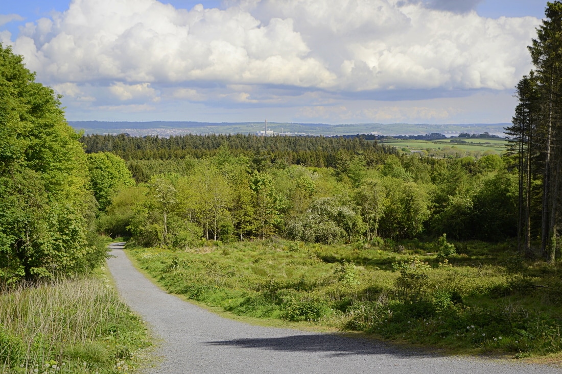 Starting off from Cairn Wood I followed the main perimeter trail up to the top of the forest and then, knowing I should be aiming southeast, picked up a minor trail which gave a glimpse of the transmitters and led towards them. The summit area was reached after passing through gaps in a couple of hedges. Having skirted the quarry edge again, I realised that my mistake last time was thinking the summit was to the right of it rather than the left. Despite the various masts and service buildings, Cairngaver’s summit is quite a peaceful place, with a trig pillar topping an old cairn that’s shaded by trees. The views are surprisingly extensive, though you’ll have to walk around a bit to appreciate them. One thing that struck me was that this area of commuter towns is still very green and pretty when seen from above. Sights included part of Belfast and its surrounding hills, the familiar, jagged line of the Mourne Mountains to the south, the mouth of Belfast Lough and the Antrim Coast to the northeast, and across the sea to Scotland and even the Isle of Man; the first time I’ve been sure I’ve seen it from Ireland. Closer to hand was the fairytale Scrabo Tower rising above Newtownards, with the Ards Peninsula beyond. 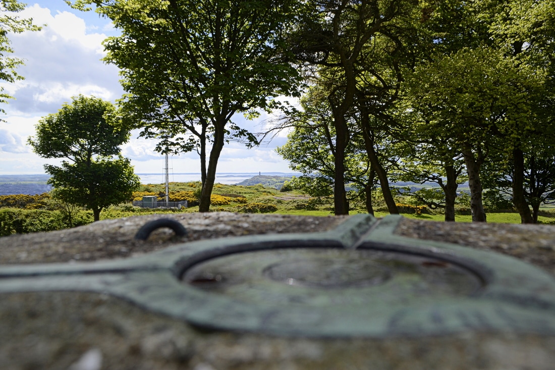 The view to Scrabo Tower and Strangford Lough from the trig pillar Having taken time to enjoy the various views, I headed back down the same way. This was a very enjoyable trip, not just because of the satisfaction in finally ‘conquering’ this obscure hill but because Cairngaver punches well above its modest height. Read more... This is a short version of an article from Martin McAlinden's own Hike Cycle Ireland blog. For the full story and a larger selection of photographs from Martin's Cairngaver walk, please visit his original article.
0 Comments
After a break for one year, the Foxford Walking Festival has returned at an earlier date in the year, the first weekend of June. The change is to try to ensure that in addition to experiencing the beauty of the North Mayo countryside, visitors will this year have an opportunity to enjoy some good weather and sunshine also. The festival will feature six guided walks over the two days with hard, moderate and easy / family walks each day. On Saturday 3rd June, the hard walk is over 16km stretch of the Ox Mountains from Drunsheen, near Bonniconlon, to Boyhollagh, near Attymass. A good level of fitness is required for this walk and water proof boots and rain gear are essential. Saturday’s moderate walk is from Foxford, through scenic Tavnaghmore, to Loch Conn and back to Foxford. An easy, family friendly walk will take participants along the River Moy towards Rinnany village and back to Foxford. 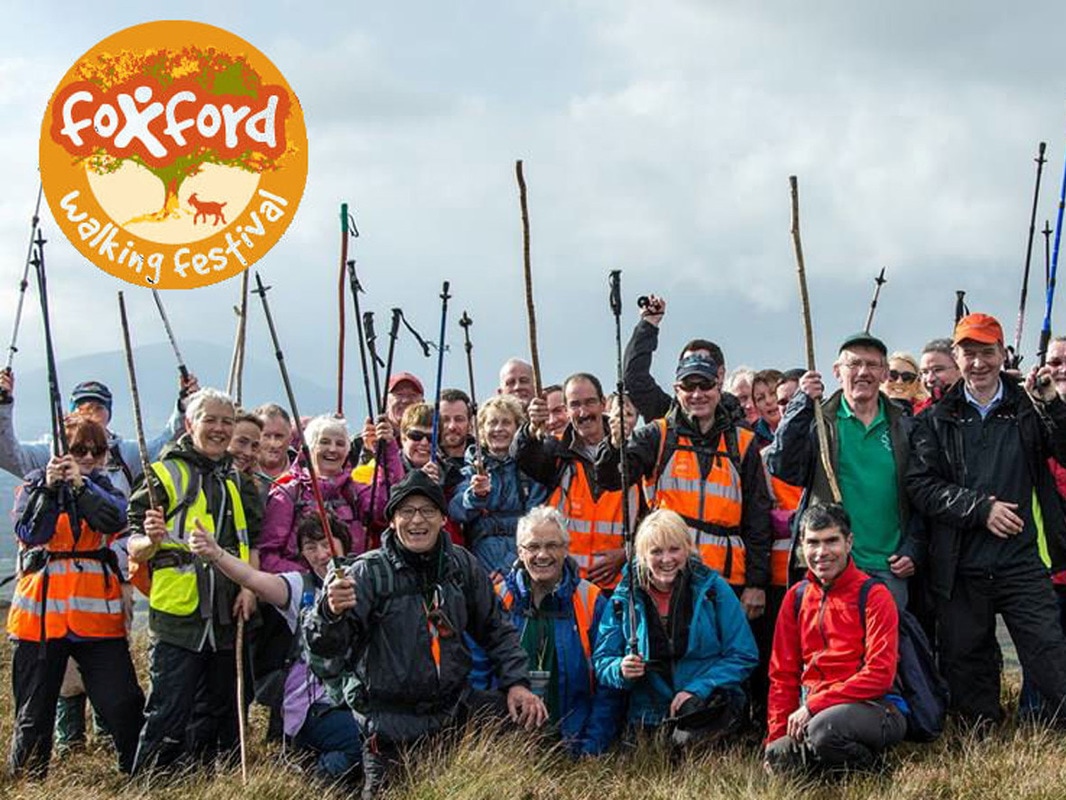 Sunday’s hard walk is a climb of Nephin starting from Lahardaun and following a steep route over some rocky terrain to the summit and returning via a completely different route to the townland of Pruglish on the opposite side of the mountain. This climb should only be attempted by those with a high level of fitness and experience of hill walking. Suitable boots and gear are essential. The moderate walk on Sunday is an ascent of scenic Laraganmore Mountain near Foxford while the easy walk is a pleasant stroll through Drummin Wood, adjacent to Lough Cullin All walks start and finish at the Foxford Sports & Leisure Centre (opposite Foxford Woollen Mills). Registration opens at 08:30. Dates for your diary:
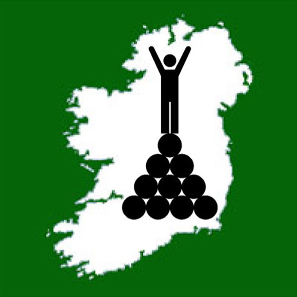
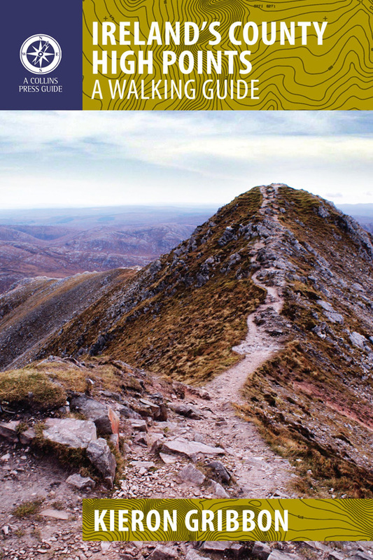
Event links: Associated Gribbon location: This article was contributed by Richard Walter of the Foxford Ramblers Walking Club As part of his mission to develop and promote high point bagging in Ireland, Kieron Gribbon has taken this informal leisure activity and transformed it into a brand new sport for all. The Irish hillwalking community has been informally involved in high point “bagging” for a good few years now. Since the 1990s, County High Point bagging has proven itself to be a particularly popular personal challenge among hillwalkers in Ireland. Its growth in popularity has been most significant since 2012 following the publication of Ireland's County High Points: A Walking Guide by Kieron Gribbon (founder of High Point Ireland). This book was the first serious initiative designed specifically to promote and develop County High Point bagging in Ireland. Soon after the guidebook was published, having recognised the makings of a new sport, Kieron set out to develop the informal activity of high point bagging into a recognised sport.
The next stage in his strategy was to publish a comprehensive list of Ireland’s major geographical high points. This was published on 5th December 2015 as the book The Gribbons: A Complete List of Ireland’s Major Geographical High Points and on the High Point Ireland website. The book was published to serve as a permanent record of the Gribbon list’s publication and as an initiative in High Point Ireland’s wider campaign to raise money for Mountain Rescue Ireland. The High Point Ireland website was set up initially to function as an information resource for hillwalkers and geography enthusiasts, and also as a platform to raise money for Mountain Rescue Ireland. The next stage of the strategy was to introduce interesting new initiatives on the website in order to build a community of high point baggers. The initiatives introduced so far have included quarterly photo competitions, awards and certificates, and the Million Metre Challenge. In April 2017, Kieron Gribbon invented the words “Highpointeering” and “Highpointeer” in preparation for the launch of his new sport. On 18th May 2017, the sport of Highpointeering was born and these newly-invented words appeared throughout the High Point Ireland website. The introduction of the High Point Ireland Leagues as the first-ever all-Ireland Highpointeering competitions officially marked the arrival of the new sport. Participants enter these competitions as individuals in the hope of becoming one of the “Elite Ten” highest point-scorers representing their home county and province. In the year-long Counties League, the three counties with the highest combined “Elite Ten” point-scores will receive Gold (1st), Silver (2nd) and Bronze (3rd) awards. Similarly, in the year-long Provinces League, the three provinces with the highest combined “Elite Ten” point-scores will also receive Gold, Silver and Bronze awards. In addition, the Highpointeer of the Year awards competition Gold, Silver and Bronze awards will be received by the three highest point-scoring individuals. In all of these open competitions, men and women, young and old, can compete with and against each other on an equal footing. At High Point Ireland, we are totally committed to an “equality for all” approach to participation in the sport of Highpointeering. As a result of having introduced all these initiatives, Highpointeering has established itself as a true sport with High Point Ireland as its natural all-Ireland governing body. Ireland is the first region in the world where High Point bagging has been developed in this way to successfully make the transition from being an informal leisure activity to becoming a sport in which individuals and sub-regions can compete with and against each other. Ireland’s convenient size, geography and topography have made this transition relatively straightforward compared to how it might be in other parts of the world. Going forward, the next stage in developing the sport of Highpointeering in Ireland is for it to become a Recognised Sport and for High Point Ireland to become its National Governing Body. As the first region of the world to embrace Highpointeering as a competitive sport, Ireland has great potential to be recognised as a key player in its global development. In the future, other regions may even create their own Highpointeering governing bodies based on the High Point Ireland model. |
Thank you for visiting the High Point Ireland blog: the dedicated news feed of the High Point Ireland website. Feel free to get in touch if you would like to become a guest blogger. Archives
June 2017
Categories
All
|
 RSS Feed
Use our affiliate links
All of our Sport Hillwalking initiatives are 100% free for you to take part in. However, please note that we do have significant operational costs which we cover on a voluntary basis ourselves. The long-term development strategy for High Point Ireland, Sport Hillwalking and our growing family of independent Irish information websites will continue to be implemented over the coming years and for as long as it takes until our strategic goals are achieved. To help us speed things along, we'd be most grateful if you would consider using the affiliate links we have set up on The Ireland Travel Guide website to buy your outdoor gear and book accommodation / transport online in the future. Using these links will not affect the price you pay at checkout. However, each purchase / booking you make could send a small commission our way at no extra cost to you. Make no mistake, this is certainly not a get-rich-quick effort, but rather a very slow drip-feed of pennies and cents to partially cover the time, effort and money we continue to invest in our range of independent projects. Thank you for your support.
Our recent news
Connect with us
Supporting good causes
|
Our supporters
|
Our partners
|
Disclaimer
If you are planning to visit any of the locations on the Irish High Point lists, please be aware that Highpointeering, rambling, hill-walking, hiking and mountaineering are risk activities. High Point Ireland and Donard Media (the website's publisher) accept no responsibility for any injury, loss or inconvenience sustained by anyone using this website. Personal safety is entirely the participant's own responsibility.
The inclusion of locations on the official list of Ireland's major geographical High Points is based entirely on each location's ability to meet the necessary criteria for at least one of the eight primary sub-lists contained on this website. It should not be assumed that access is permitted to any of the High Point locations on the list. High Point Ireland and Donard Media recommend that anyone planning to visit any of the High Point locations on the list should check for potential access restrictions and to request permission from the relevant landowner(s) in advance.
Copyright © Donard Media 2015 - 2024
|
|
|