HIGH POINT IRELAND - INFORMATION HUB
  • COVID-19
  • About
    • Contact us
    • Follow us >
      • Twitter
      • Facebook
    • FAQs
    • Accolades
    • Mission statement
    • Terms & conditions >
      • Terms & conditions for advertisers
      • Privacy policy
    • Highpointeering
    • Highpointography
    • Our point-scoring system
  • High Points
    • Locations >
      • Carrauntoohil 1,039m
      • Brandon Mountain 952m
      • Lugnaquillia Mountain 925m
      • Galtymore Mountain 918m
      • Baurtregaum 851m
      • Slieve Donard 850m
      • Mullaghcleevaun 849m
      • Mangerton Mountain 838m
      • Purple Mountain 832m
      • Mweelrea 814m
      • Nephin 806m
      • Mount Leinster 794m
      • Knockmealdown 793m
      • Kilclooney Mountain 792m
      • Stumpa Duloigh 784m
      • Mullaghanattin 773m
      • Barrclashcame 772m
      • Coomacarrea 772m
      • Croagh Patrick 764m
      • Kippure 757m
      • Errigal Mountain 751m
      • Blackstairs Mountain 735m
      • Benbaun 729m
      • Slieve Carr 721m
      • Slievenamon 721m
      • Corranabinnia 716m
      • Knockboy 706m
      • Binn idir an da Log 702m
      • Ben Gorm 700m
      • Birreencorragh 698m
      • Keeper Hill 694m
      • The Paps East 694m
      • Knocknadobar 690m
      • Croaghaun 688m
      • Hungry Hill 685m
      • Maumtrasna 682m
      • Sawel Mountain 678m
      • Croaghgorm 674m
      • Slievemore (Achill Island) 671m
      • Slieve Muck 670m
      • Cuilcagh 665m
      • Knockowen 658m
      • Mullaghanish 649m
      • Truskmore 647m
      • Musheramore 644m
      • Truskmore Southeast Slope 631m
      • Mullaghaneany 627m
      • Slieve Snaght 615m
      • Croghan Mountain 606m
      • Garraun 598m
      • Slieve League 595m
      • Slieve Foye 589m
      • Glendoo Mountain 586m
      • Slieve Anierin 585m
      • Slieve Gullion 573m
      • Oughtmore 569m
      • Trostan 550m
      • Shehy More 546m
      • Knockalongy 544m
      • Slievenanee 543m
      • Slieve Aghkerane 541m
      • Moylenanav 539m
      • Nowen Hill 535m
      • Slieve Croob 534m
      • Moylussa 532m
      • Seefin Mountain 528m
      • Arderin 527m
      • Arroo 523m
      • Mount Eagle 516m
      • Brandon Hill 515m
      • Coomagearlahy 506m
      • Raghtin More 502m
      • Foilclogh 497m
      • Bulbin 494m
      • Knockoura 490m
      • Devilsbit Mountain 480m
      • Divis 478m
      • Agnews Hill 474m
      • Loughsalt Mountain 469m
      • Minaun 466m
      • Slievereagh 465m
      • Crockauns 463m
      • Knockmore 462m
      • Cullaun 460m
      • Carrane Hill 458m
      • Tountinna 457m
      • Divis West Slope 455m
      • Baraveha 451m
      • Barnesmore 451m
      • Boleybrack 449m
      • Croaghmoyle 430m
      • Tievealehid 429m
      • Knocknaskagh 427m
      • Seltannasaggart Southeast Slope 412m
      • Bolus 410m
      • Mount Gabriel 407m
      • Maghera 400m
      • Belmore Mountain 398m
      • Slievecallan 391m
      • Croaghleheen 385m
      • Slieve Beagh 380m
      • Maumakeogh 379m
      • Cupidstown Hill 379m
      • Cappaghabaun Mountain East 378m
      • Slieve Beagh East Top 373m
      • Slievenamuck 369m
      • Culliagh Southeast Top 369m
      • Carrigatuke 365m
      • Knockalla Mountain 363m
      • Kesh Corann 359m
      • Shannavara 358m
      • Cnoc Mordain 354m
      • Clomantagh Hill 349m
      • Knocknasilloge 346m
      • Seefin 345m
      • Slieve Elva 344m
      • Tawnaghmore 340m
      • Knocknamuck 340m
      • Loughanleagh 339m
      • Gregory Hill 336m
      • Clogrennan Hill 336m
      • Crocknasmug 328m
      • Collin 328m
      • Slieve Glah 320m
      • Brougher Mountain 317m
      • Drumkeeragh Hill 315m
      • Carricktriss Gorse 314m
      • Knocknamaddree 313m
      • Carn Hill 312m
      • Woodcock Hill 310m
      • Keeraunnageeragh 305m
      • Carronadavderg 301m
      • Errisbeg 300m
      • Croaghmore 292m
      • Knockfeerina 288m
      • Crockalough 282m
      • Barranisky 280m
      • Corn Hill 278m
      • Slieve na Calliagh 276m
      • Knockanallig 267m
      • Geokaun 266m
      • Slieve Bawn 262m
      • Holywell Hill 260m
      • Mullaghmeen 258m
      • Benwee Head 255m
      • Brislagh 255m
      • Cnoc Bolais 252m
      • Scariff Island 252m
      • Croaghnamaddy 252m
      • Mount Oriel 251m
      • Croaghegly 245m
      • Knocknascollop Northwest Top 244m
      • Forth Mountain 237m
      • Croghan Hill 234m
      • Dunmurry Hill 233m
      • Cluidaniller West Top 227m
      • Murren Hill 227m
      • Inch Top 222m
      • Needles Eye 217m
      • Cairngaver 217m
      • Tearaght Island 200m
      • Knockastia 200m
      • Inishturk 191m
      • Knockbrack 176m
      • Inishnabro 175m
      • Rathmacullig 175m
      • Inishtooskert 172m
      • Knockroe 168m
      • Cnoicin an tSeabhaic 160m
      • Puffin Island 159m
      • Slieveard 134m
      • Inishmore (Galway) 123m
      • Lettermore Island 117m
      • Slievemore (Sherkin Island) 101m
      • Great Island 95m
      • Inishbofin 89m
      • Tory Island 83m
      • Inishmaan 79m
      • Meakstown 76m
      • Barnacranny Hill 75m
      • Boa Island 72m
      • Inishmore (Fermanagh) 72m
      • An Tur Faire 60m
      • Gorumna Island 53m
      • Whiddy Island 50m
    • Sub-lists >
      • Province High Points
      • County High Points
      • Local Council High Points
      • Range High Points
      • Major Island High Points
      • Major River High Points
      • 20km Isolation High Points
      • 500m Prominence High Points
      • Accessible High Points (Level 1)
      • Accessible High Points (Level 2)
      • Isol-Prom High Points
      • Essential High Points
      • Connacht High Points
      • Leinster High Points
      • Munster High Points
      • Ulster High Points
      • Mainland Ireland High Points
      • Mainland Connacht High Points
      • Mainland Munster High Points
      • Mainland Ulster High Points
  • Community
    • Participating charities
    • Our partners
    • Individuals
    • Walking guide services
    • Walking clubs
    • Walking events
    • Visitor facilities >
      • Accommodation
      • Food & Drink
      • Shopping
      • Activities
      • Transport
    • Recommended websites
    • Social media
  • Get Involved
    • Become a Highpointeer
    • Share the adventure
    • Support local businesses
    • Advertise your walking guide service
    • Advertise your walking club
    • Advertise your walking event
    • Advertise your business
  • Initiatives
    • Awards >
      • Highpointeer of the Year
      • Young Highpointeer of the Year
      • Certificates of Completion
      • Certificates of Excellence
    • Team Leagues >
      • Clubs League
      • Counties League >
        • Team County Antrim
        • Team County Armagh
        • Team County Carlow
        • Team County Cavan
        • Team County Clare
        • Team County Cork
        • Team County Derry
        • Team County Donegal
        • Team County Down
        • Team County Dublin
        • Team County Fermanagh
        • Team County Galway
        • Team County Kerry
        • Team County Kildare
        • Team County Kilkenny
        • Team County Laois
        • Team County Leitrim
        • Team County Limerick
        • Team County Longford
        • Team County Louth
        • Team County Mayo
        • Team County Meath
        • Team County Monaghan
        • Team County Offaly
        • Team County Roscommon
        • Team County Sligo
        • Team County Tipperary
        • Team County Tyrone
        • Team County Waterford
        • Team County Westmeath
        • Team County Wexford
        • Team County Wicklow
      • Provinces League >
        • Team Connacht
        • Team Leinster
        • Team Munster
        • Team Ulster
    • Challenges >
      • Set List Challenges
      • 10,000m Challenge
      • 25 High Points Challenge
    • Ireland High Points Week
    • Youth Involvement
  • Extra
    • Your stories
    • Our news
    • Highpointeer Score Form
    • Being a Highpointeer
    • Logging instructions
    • Our other websites

UPCOMING EVENT: Killarney Walking Festival 2017

15/2/2017

0 Comments


Discover the hidden valleys, mountains, reeks, lake shores and all that is beautiful and untamed about Kerry and Killarney National Park.

This year’s Killarney Walking Festival takes place from Friday 9th June to Sunday 11th June 2017. The organisers have included some new signature treks - The ‘Peaks of the Reeks’ including the iconic Carrauntoohil and Coomloughra Horseshoe treks, and Ross Castle and Innisfallen Island Tour. The Festival is a chance to enjoy a weekend of long relaxing guided walks and boat trips.

Picture
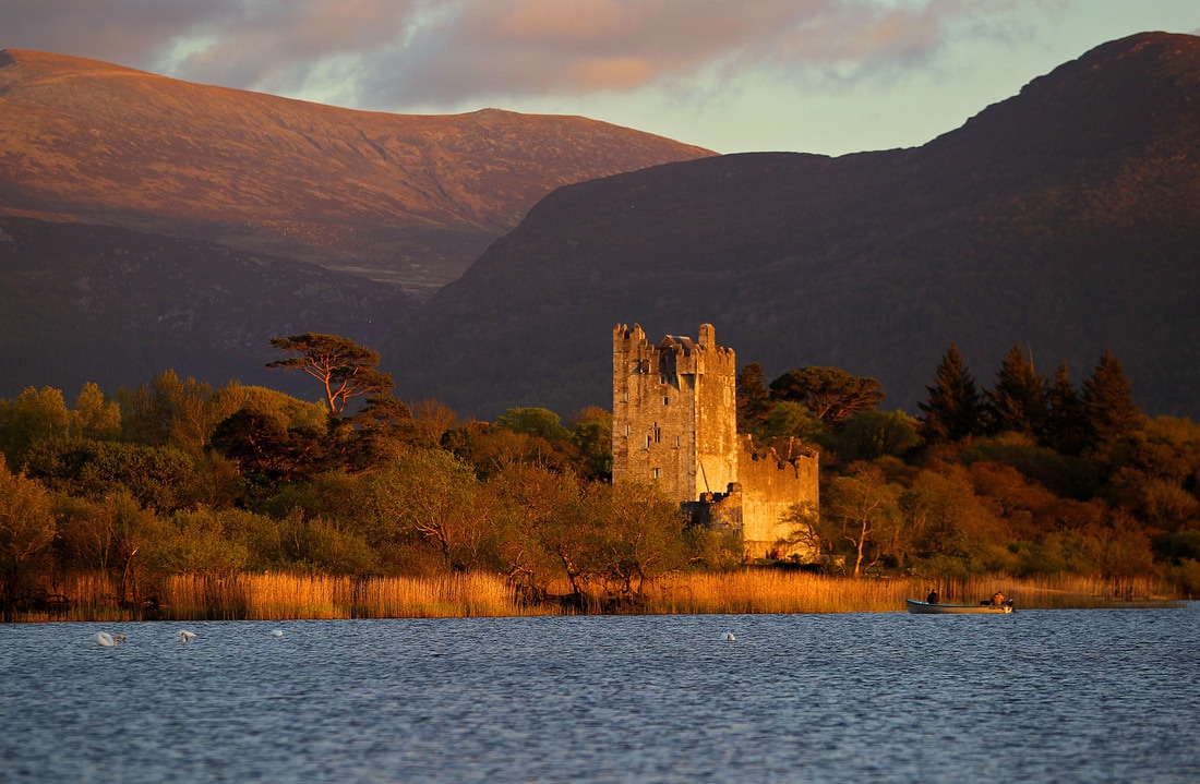
Ross Castle

This year’s signature walk is a Tour of Ross Castle and Innisfallen Island. Visit two of Killarney’s most famous landmarks, starting with a guided tour of Ross Castle which is maintained and furnished as it was in the 15th Century. Built by the O’Donoghue Ross Chieftains in the 15th Century, it remained their defensive stronghold for over 100 years until it was taken by the armies of Oliver Cromwell under General Ludlow in the year 1652.

Following on from your visit to Ross Castle, enjoy a boat trip to the early Christian monastic site and oratory on Innisfallen Island where St. Fionán Lobhar founded his 6th century monastery. It was here that the world renowned Annals Innisfallen were compiled. The visit to Innisfallen Island will include a one-hour guided walk of the island with panoramic views of the surrounding Lough Leane.

Picture
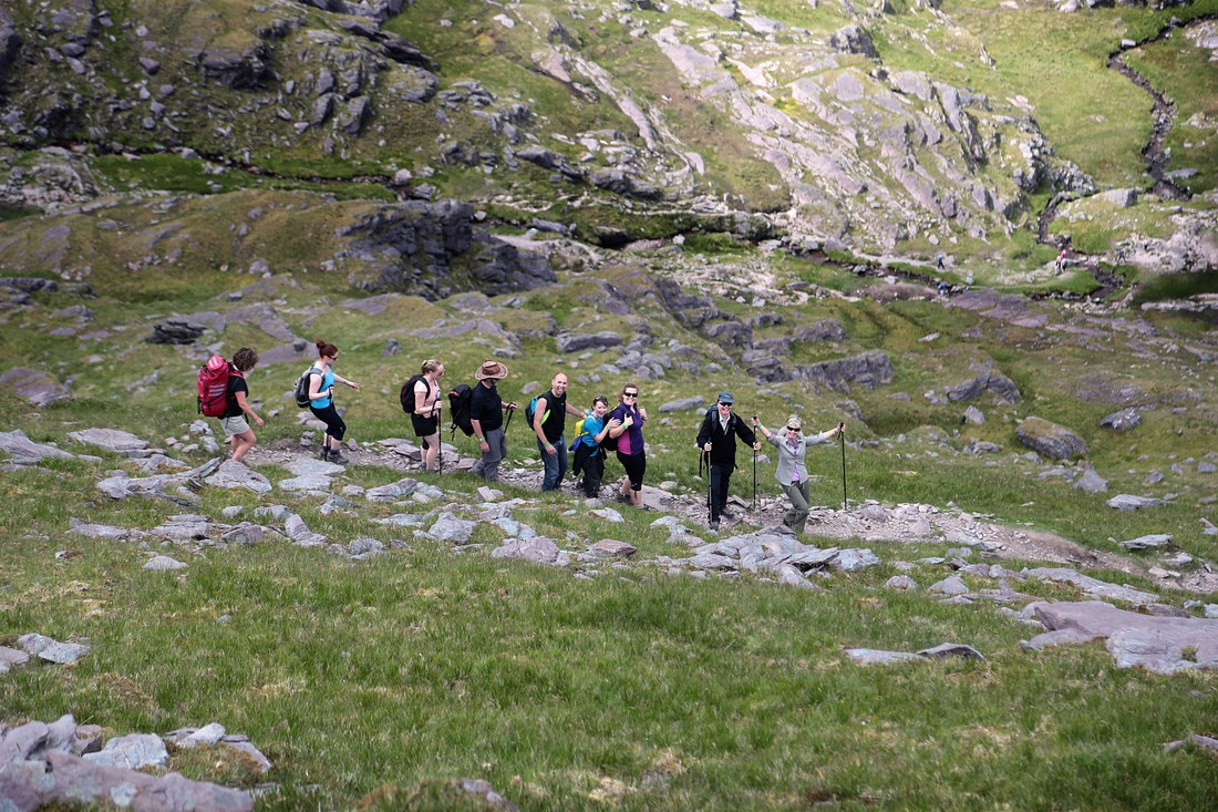
Ascending Carrauntoohil

Other Signature walks include, The Coomloughra Horseshoe trek along the MacGillycuddy's Reeks, Summit of Carrauntoohil, Mangerton and Torc Mountain Paths, Gap of Dunloe Boat Trip, Tomies and Purple and the Old Kenmare Road,
 
This year’s Charity Walk in aid of Kerry Parents and Friends, is a Sun ‘SET’ on Strickeen, on Friday evening, June 9th, departing Kate Kearney’s Cottage at 7.30pm. Strickeen is part of MacGillycuddy’s Reeks mountain range, at 440m; it follows a path to the top until an ancient cairn/ritual greets the walker. Here is where the ‘craic’ begins - Walkers will be asked to dance an entire Kerry Polka on the summit, just bring a tin whistle and a bodhrán! The Charity Kerry Parent and Friends plays an enormous role in the lives of families in Kerry living with intellectual disability.

Picture
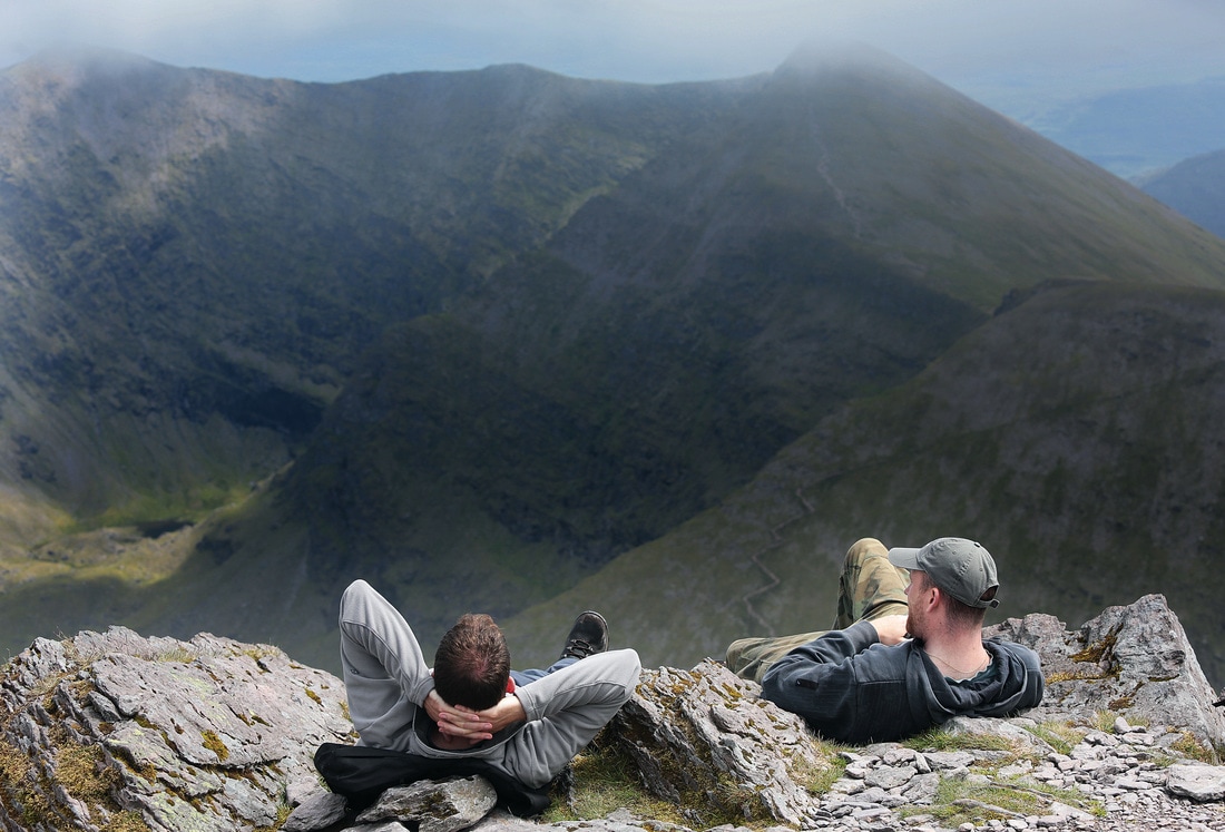
Relaxing on Carrauntoohil

John O’Sullivan, Reeks Lodge and Guiding said “This festival is for everyone - families, walking clubs and anyone who loves the great outdoors. The schedule of walks has something for all ages and abilities, from strenuous category three hikes to easy low level category one walks. From the challenging MacGillycuddy’s Reeks hike to the leisurely wood trails and Innisfallen Island by boat. There are 10 guided walks to choose from in all”. Also guiding are the experienced Killarney Guides Ray and Mary Walsh of ‘Walk with Me’.

Dates for your diary:
  • 9th, 10th & 11th June 2017

Event links:
  • The official event website

Associated Gribbon locations:
  • Carrauntoohil (1,039m)
  • Mangerton Mountain (838m)
  • Purple Mountain (832m)

This article was contributed by the Killarney Walking Festival event organisers

0 Comments

Your comment will be posted after it is approved.


Leave a Reply.

    Thank you for visiting the High Point Ireland blog: the  dedicated news feed of the High Point Ireland website. Feel free to get in touch if you would like to become a guest blogger.

    Archives

    June 2017
    May 2017
    February 2017
    January 2017

    Categories

    All
    2016
    Certificate Of Completion
    Certificate Of Excellence
    Competition
    County Gribbons
    Highpointeer Of The Year
    #HighPointIrelandPhoto
    Local Council Gribbons
    Range Gribbons
    Review
    Upcoming Event
    Walk Report

    RSS Feed


Our recent news


Follow us


Home
About
High Points
Community
Get involved
Initiatives
News Hub
Extra

Supporting good causes

Our supporters


Our partners

Walking links


Disclaimer


If you are planning to visit any of the locations on the Gribbon list of Ireland's major geographical High Points, please be aware that Highpointeering, rambling, hill-walking, hiking, mountaineering, mountain running and cycling are risk sports. High Point Ireland, Kieron Gribbon (the website's author and founder of High Point Ireland) and Donard Media (the website's publisher) accept no responsibility for any injury, loss or inconvenience sustained by anyone using this website. Personal safety is entirely the participant's own responsibility.
The inclusion of locations on the Gribbon list of Ireland's major geographical High Points is based entirely on each location's ability to meet the necessary criteria for at least one of the eight primary sub-lists contained on this website. It should not be assumed that access is permitted to any of the High Point locations on the list. High Point Ireland, Kieron Gribbon and Donard Media recommend that anyone planning to visit any of the High Point locations on the list should check for potential access restrictions and to request permission from the relevant landowner(s) in advance.

Copyright © Donard Media 2015 - 2021


The Ireland Walking Guide - www.theirelandwalkingguide.com
The Ireland Sightseeing Guide - www.theirelandsightseeingguide.com
High Point Ireland - www.highpointireland.com
The Ireland Geography Guide - www.theirelandgeographyguide.com
Ireland's County High Points: A Walking Guide

  • COVID-19
  • About
    • Contact us
    • Follow us >
      • Twitter
      • Facebook
    • FAQs
    • Accolades
    • Mission statement
    • Terms & conditions >
      • Terms & conditions for advertisers
      • Privacy policy
    • Highpointeering
    • Highpointography
    • Our point-scoring system
  • High Points
    • Locations >
      • Carrauntoohil 1,039m
      • Brandon Mountain 952m
      • Lugnaquillia Mountain 925m
      • Galtymore Mountain 918m
      • Baurtregaum 851m
      • Slieve Donard 850m
      • Mullaghcleevaun 849m
      • Mangerton Mountain 838m
      • Purple Mountain 832m
      • Mweelrea 814m
      • Nephin 806m
      • Mount Leinster 794m
      • Knockmealdown 793m
      • Kilclooney Mountain 792m
      • Stumpa Duloigh 784m
      • Mullaghanattin 773m
      • Barrclashcame 772m
      • Coomacarrea 772m
      • Croagh Patrick 764m
      • Kippure 757m
      • Errigal Mountain 751m
      • Blackstairs Mountain 735m
      • Benbaun 729m
      • Slieve Carr 721m
      • Slievenamon 721m
      • Corranabinnia 716m
      • Knockboy 706m
      • Binn idir an da Log 702m
      • Ben Gorm 700m
      • Birreencorragh 698m
      • Keeper Hill 694m
      • The Paps East 694m
      • Knocknadobar 690m
      • Croaghaun 688m
      • Hungry Hill 685m
      • Maumtrasna 682m
      • Sawel Mountain 678m
      • Croaghgorm 674m
      • Slievemore (Achill Island) 671m
      • Slieve Muck 670m
      • Cuilcagh 665m
      • Knockowen 658m
      • Mullaghanish 649m
      • Truskmore 647m
      • Musheramore 644m
      • Truskmore Southeast Slope 631m
      • Mullaghaneany 627m
      • Slieve Snaght 615m
      • Croghan Mountain 606m
      • Garraun 598m
      • Slieve League 595m
      • Slieve Foye 589m
      • Glendoo Mountain 586m
      • Slieve Anierin 585m
      • Slieve Gullion 573m
      • Oughtmore 569m
      • Trostan 550m
      • Shehy More 546m
      • Knockalongy 544m
      • Slievenanee 543m
      • Slieve Aghkerane 541m
      • Moylenanav 539m
      • Nowen Hill 535m
      • Slieve Croob 534m
      • Moylussa 532m
      • Seefin Mountain 528m
      • Arderin 527m
      • Arroo 523m
      • Mount Eagle 516m
      • Brandon Hill 515m
      • Coomagearlahy 506m
      • Raghtin More 502m
      • Foilclogh 497m
      • Bulbin 494m
      • Knockoura 490m
      • Devilsbit Mountain 480m
      • Divis 478m
      • Agnews Hill 474m
      • Loughsalt Mountain 469m
      • Minaun 466m
      • Slievereagh 465m
      • Crockauns 463m
      • Knockmore 462m
      • Cullaun 460m
      • Carrane Hill 458m
      • Tountinna 457m
      • Divis West Slope 455m
      • Baraveha 451m
      • Barnesmore 451m
      • Boleybrack 449m
      • Croaghmoyle 430m
      • Tievealehid 429m
      • Knocknaskagh 427m
      • Seltannasaggart Southeast Slope 412m
      • Bolus 410m
      • Mount Gabriel 407m
      • Maghera 400m
      • Belmore Mountain 398m
      • Slievecallan 391m
      • Croaghleheen 385m
      • Slieve Beagh 380m
      • Maumakeogh 379m
      • Cupidstown Hill 379m
      • Cappaghabaun Mountain East 378m
      • Slieve Beagh East Top 373m
      • Slievenamuck 369m
      • Culliagh Southeast Top 369m
      • Carrigatuke 365m
      • Knockalla Mountain 363m
      • Kesh Corann 359m
      • Shannavara 358m
      • Cnoc Mordain 354m
      • Clomantagh Hill 349m
      • Knocknasilloge 346m
      • Seefin 345m
      • Slieve Elva 344m
      • Tawnaghmore 340m
      • Knocknamuck 340m
      • Loughanleagh 339m
      • Gregory Hill 336m
      • Clogrennan Hill 336m
      • Crocknasmug 328m
      • Collin 328m
      • Slieve Glah 320m
      • Brougher Mountain 317m
      • Drumkeeragh Hill 315m
      • Carricktriss Gorse 314m
      • Knocknamaddree 313m
      • Carn Hill 312m
      • Woodcock Hill 310m
      • Keeraunnageeragh 305m
      • Carronadavderg 301m
      • Errisbeg 300m
      • Croaghmore 292m
      • Knockfeerina 288m
      • Crockalough 282m
      • Barranisky 280m
      • Corn Hill 278m
      • Slieve na Calliagh 276m
      • Knockanallig 267m
      • Geokaun 266m
      • Slieve Bawn 262m
      • Holywell Hill 260m
      • Mullaghmeen 258m
      • Benwee Head 255m
      • Brislagh 255m
      • Cnoc Bolais 252m
      • Scariff Island 252m
      • Croaghnamaddy 252m
      • Mount Oriel 251m
      • Croaghegly 245m
      • Knocknascollop Northwest Top 244m
      • Forth Mountain 237m
      • Croghan Hill 234m
      • Dunmurry Hill 233m
      • Cluidaniller West Top 227m
      • Murren Hill 227m
      • Inch Top 222m
      • Needles Eye 217m
      • Cairngaver 217m
      • Tearaght Island 200m
      • Knockastia 200m
      • Inishturk 191m
      • Knockbrack 176m
      • Inishnabro 175m
      • Rathmacullig 175m
      • Inishtooskert 172m
      • Knockroe 168m
      • Cnoicin an tSeabhaic 160m
      • Puffin Island 159m
      • Slieveard 134m
      • Inishmore (Galway) 123m
      • Lettermore Island 117m
      • Slievemore (Sherkin Island) 101m
      • Great Island 95m
      • Inishbofin 89m
      • Tory Island 83m
      • Inishmaan 79m
      • Meakstown 76m
      • Barnacranny Hill 75m
      • Boa Island 72m
      • Inishmore (Fermanagh) 72m
      • An Tur Faire 60m
      • Gorumna Island 53m
      • Whiddy Island 50m
    • Sub-lists >
      • Province High Points
      • County High Points
      • Local Council High Points
      • Range High Points
      • Major Island High Points
      • Major River High Points
      • 20km Isolation High Points
      • 500m Prominence High Points
      • Accessible High Points (Level 1)
      • Accessible High Points (Level 2)
      • Isol-Prom High Points
      • Essential High Points
      • Connacht High Points
      • Leinster High Points
      • Munster High Points
      • Ulster High Points
      • Mainland Ireland High Points
      • Mainland Connacht High Points
      • Mainland Munster High Points
      • Mainland Ulster High Points
  • Community
    • Participating charities
    • Our partners
    • Individuals
    • Walking guide services
    • Walking clubs
    • Walking events
    • Visitor facilities >
      • Accommodation
      • Food & Drink
      • Shopping
      • Activities
      • Transport
    • Recommended websites
    • Social media
  • Get Involved
    • Become a Highpointeer
    • Share the adventure
    • Support local businesses
    • Advertise your walking guide service
    • Advertise your walking club
    • Advertise your walking event
    • Advertise your business
  • Initiatives
    • Awards >
      • Highpointeer of the Year
      • Young Highpointeer of the Year
      • Certificates of Completion
      • Certificates of Excellence
    • Team Leagues >
      • Clubs League
      • Counties League >
        • Team County Antrim
        • Team County Armagh
        • Team County Carlow
        • Team County Cavan
        • Team County Clare
        • Team County Cork
        • Team County Derry
        • Team County Donegal
        • Team County Down
        • Team County Dublin
        • Team County Fermanagh
        • Team County Galway
        • Team County Kerry
        • Team County Kildare
        • Team County Kilkenny
        • Team County Laois
        • Team County Leitrim
        • Team County Limerick
        • Team County Longford
        • Team County Louth
        • Team County Mayo
        • Team County Meath
        • Team County Monaghan
        • Team County Offaly
        • Team County Roscommon
        • Team County Sligo
        • Team County Tipperary
        • Team County Tyrone
        • Team County Waterford
        • Team County Westmeath
        • Team County Wexford
        • Team County Wicklow
      • Provinces League >
        • Team Connacht
        • Team Leinster
        • Team Munster
        • Team Ulster
    • Challenges >
      • Set List Challenges
      • 10,000m Challenge
      • 25 High Points Challenge
    • Ireland High Points Week
    • Youth Involvement
  • Extra
    • Your stories
    • Our news
    • Highpointeer Score Form
    • Being a Highpointeer
    • Logging instructions
    • Our other websites